
")


دیگر خدمات عکاسی
برای آشنایی با دیگر پروژه ها و خدمات گروه بهرام عابدینی و یا آشنایی با تیم عکسبرداری و فیلم برداری گزینه های زیر را انتخاب کنید و یا اگر آماده تماس و ثبت سفارش هستید به صفحه تماس با ما بروید
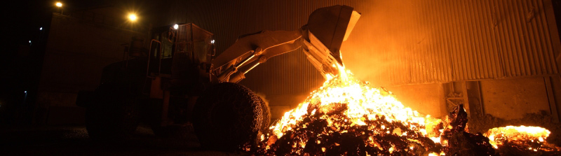
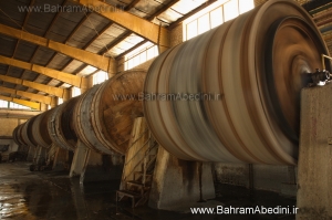
عکاسی صنعتی حرفه ای
- عکاسی آتلیه
- عکاسی از محصولات
- عکاسی کروی و 360 درجه
- عکاسی هوایی با drone
- فیلم برداری صنعتی
- عکسبرداری تایم لپس
تماس و ثبت سفارش
- صفحه سوالات متداول
- پرسش و پاسخ عکاسی
- تماس با ما
- ثبت سفارش عکسبرداری
- ثبت سفارش فیلم برداری
- خرید عکس
عکاسی 360 درجه
- عکس چرخشی از محصولات
- عکس قابل کنترل برای مویابل
- عکس از محصولات برای فروشگاه اینترنتی
- عکس 360 درجه پانورامیک
- عکس پانوراما از منازل و فضاهای داخلی و خارجی