آخرین عکس های طبیعت و مناظر ایران
بهرام عابدینی
آخرین عکس های طبیعت و مناظر ایران
آخرین عکس های طبیعت و مناظر ایران
بهرام عابدینی
بهرام عابدینی
Website Language

")

Farsi Description:
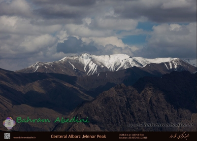
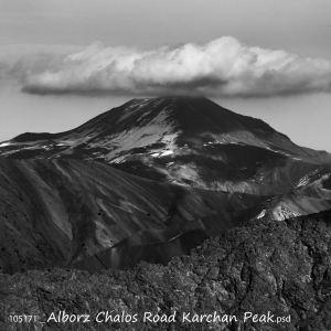
قلهٔ کرچان در رشتهکوه البرز مرکزی واقع شده و یکی از قلههای محبوب کوهنوردان است. این قله با ارتفاعی حدود ۳۹۰۰ متر (بسته به مسیر اندازهگیری) چشماندازی وسیع به دشت هراز، قلههای دماوند و منطقهٔ پلور دارد. مسیرهای صعود معمولاً از روستاهای نوا یا پلور آغاز میشود و به دلیل مناظر بکر، سکوت کوهستان و نزدیکی به تهران مقصدی جذاب برای صعود یکروزه یا دوروزه است.
به این عکس امتیاز دهید.
این عکس توسط بهرام عابدینی از تپه ها و طبیعت اطراف این منطقه گرفته شده است. برای خرید این عکس یا عکس های دیگر از طریق وبسایت یا تلفن با ما تماس بگیرید.
توضیحات انگلیسی:
Karchan Peak is located in the Central Alborz mountain range and is a popular destination for climbers. Standing at an elevation of about 3,900 m, it offers wide, breathtaking views of the Haraz plain, Mount Damavand, and the surrounding Plour region. The usual ascent routes start from the villages of Nava or Plour, making it an attractive choice for a one-day or two-day climb thanks to its pristine landscapes, peaceful mountain atmosphere, and convenient access from Tehran.
Please rate this picture.
This picture is taken by Bahram Abedini. If you want to purchase this picture or any other around this area please contact us through website, email or phone.
We sell pictures digitally in Large format and internationally through secure paypal payment in the US.
Farsi Description:
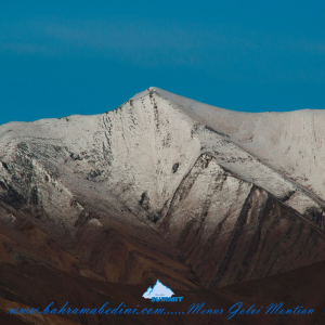
قله منا ر و گلوی به ارتفاع تقریبی سه وهزارو پانصد متر در شمال روستای واریان وجنوب شرقی روستای مورودقرار دارد این دوقله در خطالراس سیاه سنگ منار و گلوی و گلو سربند واقع است راه صعود به قله بیشتر از روستای مورود است آبشار های که از قله ها سرازیر می شود یکی آبشا ر چهار صد تنور در جنوب و آبشار رفک در شمال این کوه قرار دارد.
به این عکس امتیاز دهید.
این عکس توسط بهرام عابدینی از تپه ها و طبیعت اطراف این منطقه گرفته شده است. برای خرید این عکس یا عکس های دیگر از طریق وبسایت یا تلفن با ما تماس بگیرید.
توضیحات انگلیسی:
Please rate this picture.
The peaks of Manar and Golou, with an approximate height of 3,500 meters, are located north of the village of Varyan and southeast of the village of Moroud. These two peaks are situated on the ridge of Siah Sang Manar and Golou and Golou Sarband. The main route to ascend the peaks is from the village of Moroud. The waterfalls that flow from the peaks include the Four Hundred Tanur waterfall in the south and the Rafak waterfall in the north of this mountain."
This picture is taken by Bahram Abedini. If you want to purchase this picture or any other around this area please contact us through website, email or phone.
We sell pictures digitally in Large format and internationally through secure paypal payment in the US.
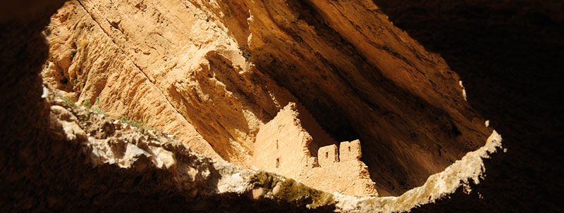
Farsi Description:
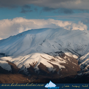
کوه پهنه حصار یک قله برجسته در کوههای البرز مرکزی در شمال ایران، نزدیک روستای سنگان بالا است. این کوه به خاطر مسیرهای دیدنی، مناظر متنوع و تنوع زیستی غنی خود شناخته شده است. این منطقه شامل آبشار چشمگیر سنگان نیز میشود که آن را به مقصدی محبوب برای کوهنوردان و علاقهمندان به طبیعت تبدیل کرده است.
به این عکس امتیاز دهید.
این عکس توسط بهرام عابدینی از تپه ها و طبیعت اطراف این منطقه گرفته شده است. برای خرید این عکس یا عکس های دیگر از طریق وبسایت یا تلفن با ما تماس بگیرید.
توضیحات انگلیسی:
The Mountain of Pahne Hesar is a prominent peak in the Central Alborz Mountains of northern Iran, near the village of Sangan Bala. It's known for its scenic trails, diverse landscapes, and rich biodiversity. The area includes the impressive Sangan Waterfall, making it a popular destination for hikers and nature enthusiasts.
Please rate this picture.
This picture is taken by Bahram Abedini. If you want to purchase this picture or any other around this area please contact us through website, email or phone.
We sell pictures digitally in Large format and internationally through secure paypal payment in the US.
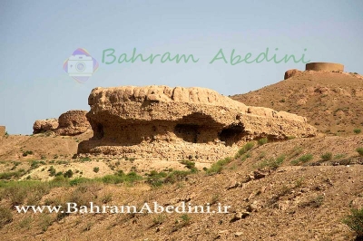
Farsi Description:
به این عکس امتیاز دهید.
این عکس توسط بهرام عابدینی از تپه ها و طبیعت اطراف این منطقه گرفته شده است. برای خرید این عکس یا عکس های دیگر از طریق وبسایت یا تلفن با ما تماس بگیرید.
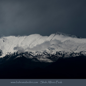
قله شاه البرز با ارتفاع ۴۱۷۰ متر، در مرز استانهای البرز و قزوین قرار دارد و مرز طبیعی بین دره طالقان و دره الموت است. این قله دارای پنج قله فرعی بالای ۴۰۰۰ متر است و مسیرهای صعود آن از روستاهای حسنجون، هرنج و سی چشمه در طالقان و جاده الموت انجام میشود. شاه البرز به دلیل چشماندازهای زیبا و طبیعت بکر، مقصد محبوبی برای کوهنوردان است.
توضیحات انگلیسی:
Please rate this picture.
This picture is taken by Bahram Abedini. If you want to purchase this picture or any other around this area please contact us through website, email or phone.
Shah Alborz Peak, standing at 4,170 meters, is located on the border of Alborz and Qazvin provinces, forming a natural boundary between Taleghan Valley and Alamut Valley. It has five subsidiary peaks over 4,000 meters. The ascent routes typically start from the villages of Hasanjoon, Haranj, and Si Cheshmeh in Taleghan, as well as from the Alamut road. Due to its beautiful landscapes and pristine nature, Shah Alborz is a popular destination for mountaineers.
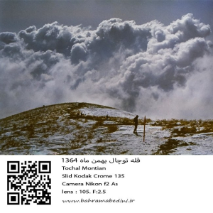
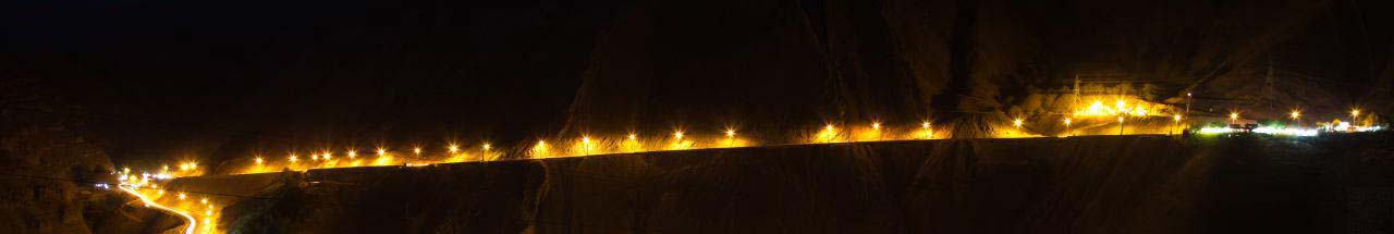
عکسی از قله توچال در سال 1364 در ماه بهمن
مشخصات دوربین و لنز در زیر عکس ذکر شده است.
به این عکس امتیاز دهید.
این عکس توسط بهرام عابدینی از تپه ها و طبیعت اطراف این منطقه گرفته شده است. برای خرید این عکس یا عکس های دیگر از طریق وبسایت یا تلفن با ما تماس بگیرید.
English description:
In 1985, Tochal Mountain in Iran, part of the Alborz range, was a popular destination for its stunning views and rugged terrain. Standing at 3,963 meters, it featured various peaks and trails for hikers and climbers. The Tochal Telecabin, a gondola lift, provided easy access to higher altitudes and the ski resort. The mountain’s proximity to Tehran made it a quick escape for outdoor enthusiasts, with shelters like Shirpala and Siahsang offering rest stops. Overall, Tochal was a cherished natural landmark blending adventure and tranquility.
Please rate this picture.
This picture is taken by Bahram Abedini. If you want to purchase this picture or any other around this area please contact us through website, email or phone.
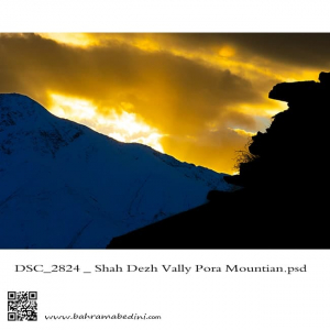
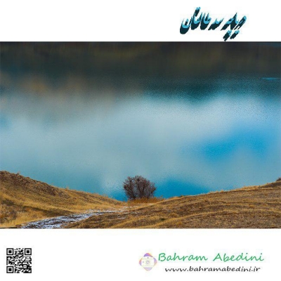
The valley of Shah dej in a sunset
This picture has been taken on my recent hiking in the region , the summit in the picture is the Poora peak
دره شاه دژ و قله پورا در پس زمینه
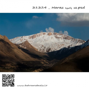
البرز شرقی قله پاشوره 3900 متر در جوار قله عبرت وقله امیری
This is a picture from the eastern Alborz mountain range. The peak in the picture is called Pashooreh, it has a height of 3900 meters from mean sea level which is (12795.28 ft) . the other summit beside it , is called Ebrat summit. and the other one, Amiri summit.
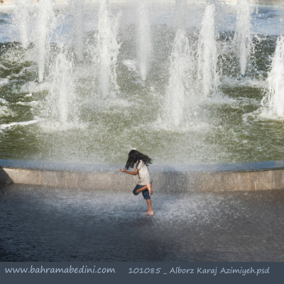
Mountain photography is the art of capturing nature at its core, and having the colors as natural as it can be. The framing is also important in mountain photography. it should be very inclusive of the nature around the mountains. Light in nature photography is important as to help viewers get the feeling of the nature right there. Therefore, it is not advisable to always have a bright and high visibility. Nature as it comes has darkness and brightness. there is sunrise and sunset and all makes different lighting in the atmosphere around it.
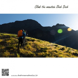
عکسی از صعود به قله شاه دژ در رشته کوه البرز
Hiking the Shah-Dej Summit
Shah-dej is part of the alborz mountain range which is located north iran. most of the summits are 13000 ft and up from mean sea level.
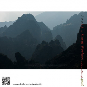
Martian mountains of Purkan.Pourekan is a small village in the region of the city of Karaj which is in north-central Iran. The mountain ranges of Alborz is very dominant in this region and the village is considered a mountainous village. if you like what you see, you can buy it by contacting me.
North of Iran
عکسی از کوه های مریخی پورکان
پورکان از توابع شهر کرج محسوب میشود که مردمانی خونگرم دارد که به زبان تاتی صحبت میکنند. تاتی در زمان قدیم رایج بوده است ولی اکنون به محدود استان البرز و قزوین محدود شده است. رشته کوه های البرز در این منطقه بسیار زیبا و چشم نواز هستند و این عکس هم نمونه ای از این منطقه است.
در صورت علاقه به خرید این عکس با من تماس بگیرید.
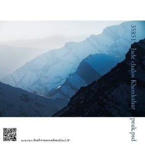
یال قله خونکهار
رشته کوه البرز
KhonKahar mountain
Alborz mountain ranges
North of Iran